Monday, August 31, 2009

Cycling: Canada's Wonderland

After the Tour of Toronto, I got to thinking that I'd done very little cycling outside the city's boundarys (except along the lake towards Hamilton), and started wondering what the trails were like north of Steeles.

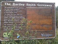
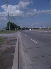
During the Toronto Tour, I came across a sign for the Bartley Smith Greenway, which seemed a good place to start. The trail runs north from Steeles directly across from G. Ross Lord Park, which I'd only biked through once before, so it seemed a good place to start. Using Google Earth, I eyeballed where the trails went and how they connected -- or how to get between them if they didn't connect -- and put together a route that ran north from about the 401/Allen Expresssway interchange all the way up to Canada's Wonderland, then south again by way of Black Creek and the Humber River.

I ended up tweeting the ride again, though without as many photos as the Toronto tour:


11:15 AM Aug 30th: Trying a new cycling route. Let's see how this goes...

The first part of the ride was very familiar: up through Rosedale then along the Belt Line Trail to the Allen Expressway. North from the Allen was moderately familiar -- there isn't really a bike trail there, so it's all residential streets.


12:11 PM Aug 30th: Ok, reached the new part of the route. Time to not get myself lost.

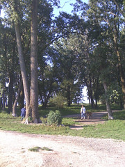
Now I was at Baycrest Park, which I hadn't ridden through before. This was supposed to connect to a series of valley trails that would take me up to G. Ross Lord Park.


12:39 PM Aug 30th: First time through Earl Bales park. Really nice trail - well forested.

This was a great trail. I wish the Don Valley and Rosedale Golf Clubs didn't keep this trail from connecting to the West Don. That'd be a great route.


12:57 PM Aug 30th: Note to self: next time, don't use the trail behind the Jewish Centre on the West Don to get out of the valley...

First big mistake in the plan. Google Earth shows a trail behind the Jewish Community Centre of Toronto on Bathrust. Well, the trail is there... But it runs up a steep climb and is paved entirely with coarse gravel. Completely unmanagable on my recumbent. I ended up walking that climb.


1:18 PM Aug 30th: This is not that helpful:

This is Not That Helpful


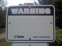
This is in G. Ross Lord Park, which has great wooded trails. I have no idea what it's supposed to be warning against.


1:19 PM Aug 30th: This is, though:

This Is Helpful


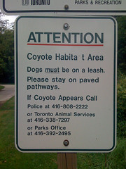
I didn't see any, though.


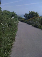
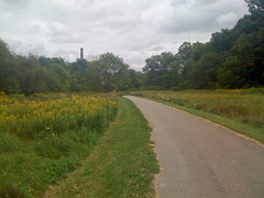
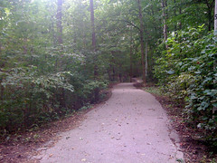
1:26 PM Aug 30th: Great creek-side trail in G. Ross Lord park:

G. Ros Lord Park


After a stretch in the woods, the trail moves to a wide-open flood plain. This trip largely alternated between woods, meadows, and streets, in a pretty nice balance.


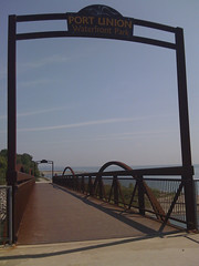
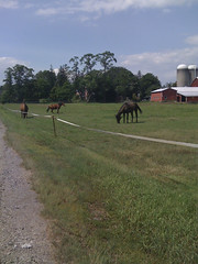
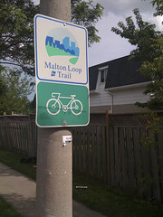
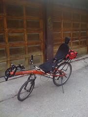
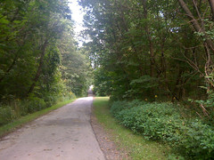
1:32 PM Aug 30th: Last time I was here, I said I'd have to investigate. So, time to do so!

Time To Investigate


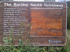
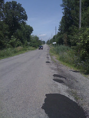
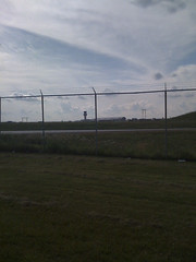
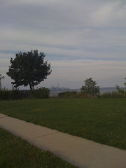
The sign for the Bartley Smith Greenway that I saw during the Tour of Toronto ride. This marks the start of my first real ride north of Steeles (as opposed to those short jaunts into parking lots to grab lunch with in 100m of the street).


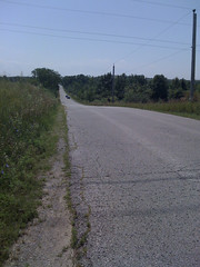
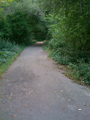
1:50 PM Aug 30th: Nice trail:

Nice Trail


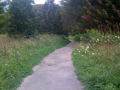
The Greenway didn't disappoint, except for being too short. It only ran maybe half a kilometer on a diagonal from Steeles to Dufferin. Fortunately, other trails picked up where it left off. On the west side of Dufferin, the trails in Marita Paine Park and Geln Shields Park actually have tunnels running under the suburban roads so that pedestrians and cyclist barely have to worry about traffic at all.


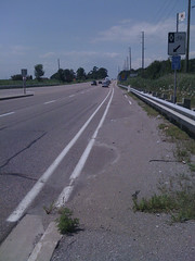
1:52 PM Aug 30th: First time biking past the 407:

First Time Biking Past the 407


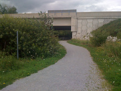
My prefered way of crossing a major freeway on a bike: along a dedciated path underneath.


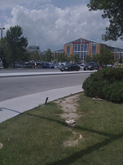
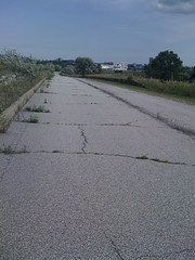
2:11 PM Aug 30th: This looks less overgrown on Google Earth:

This Looks Less Overgrown on Google Earth


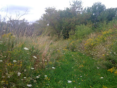
The second major failure in the plan: this looks like a paved path on Google Earth. It's the winding path that runs up between the trees in this view:


It turns out it's kind of abandoned. I could follow the trail for about 200m, but eventually it was so badly overgrown -- and so infested with mosquitos -- that I picked up my bike and hauled it straight through the trees. I just happened to meet the fece for the lot behind the big rectangular building on Basaltic at a point where it was partly collapsed, and I could get the bike over it. Unfortunately, I discovered later that I broke my bell in the process...


2:23 PM Aug 30th: Note to self: when planning a ride using Google Earth, remember that some roads might not exist anymore...

This is important to remember.


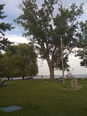
2:39 PM Aug 30th: Odd little house:

Odd Little House


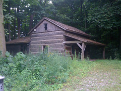
All I know about this house is that it's behind a fence at the east end of a wooded area called Cromwell Park.


3:07 PM Aug 30th: Reached the north end of the ride. It's downhill from here!

Reached the North End of the Ride


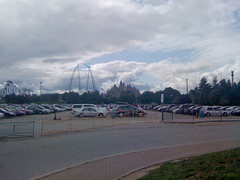
Actually, this is slightly south of the northernmost end of the ride. But it's the official terminus.

From Canada's Wonderland, I just took Creditstone Road south all the way to the 407. Normally, I'm not that fond of riding on suburban industrial roads, but Sunday was very nicely overcast, which took care of my biggest gripe -- the lack of shade. Throw in almost no traffic and a slight downhill grade, and I just zipped along.


3:44 PM Aug 30th: Crossing 407 again.

Crossing 407 Again


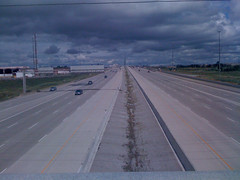
My least favourite way of crossing a major freeway on a bike: on a busy overpasss with a strong cros-wind.


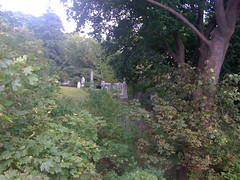
3:53 PM Aug 30th: Back in Toronto: Black Creek Pioneer Village cemetery.

Black Creek Pioneer Village Cemetery


I realized a little after this that I should have gone along Steeles for a block and into the Black Creek valley from Murray Ross Parkway, rather than down Jane to Shoreham. Oh well, next time.


4:12 PM Aug 30th: Another great creek trail: Black Creek

Black Creek Trail


Yet again another great wooded trail. My only gripe with Black Creek -- and it applies to a number of other ravine trails in Toronto -- is that there are a number of places where you have to climb a steep grade up to a busy road, get across, and ride down a steep grade on the other side. A tunnel would be much more convenient -- and safer.


4:32 PM Aug 30th: Nasty climb:

Nasty Climb


This is the climb from Downsview Dells Park to Langholm Drive, but the picture doesn't do it justice. For starters, the first 50m of the trail from the Downsview Dells parking lot isn't paved -- it's practically marsh. Unridable. Then the climb out of the park is a killer.


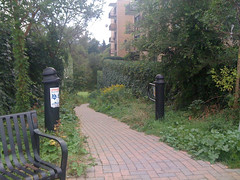
4:39 PM Aug 30th: A nice, short trail between cul-de-sacs: Giovanni Caboto Park

Giovanni Cabotto Park


I'd never ridden this park before. Google Maps labels this Tavistock Park at the start, then Exbury Park further down, though the sign across from where I entered said Giovanni Cabotto. Whatever the name is, it's a nice ride, though, again, only a few hundred meters long. You come out of the woods and connect to the Heathrow and Chalfkarm Greenbelts, which are trails through standard, open parks.


5:14 PM Aug 30th: I always have trouble spotting this entrance to the Humber trail:

I Always Have Trouble Spotting This Entrance


On the Humber, you can get from Steeles to the lake entirely on paved multi-use paths, except for a 600m stretch from Fairglen Crescent to Conron Place. A combination of a steep cliff on the east bank and the Weston Golf & Country Club on the west bank has prevented the city connecting the two sections.


5:23 PM Aug 30th: The remains of Raymore Bridge, destroyed in 1954 by Hurricane Hazel, along with many valley houses:

The Remains of Raymore Bridge


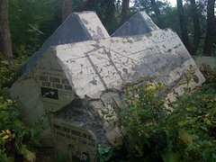
This is one of my favourite "sculptures" in Toronto. It's one of the anchor blocks of the Raymore Bridge, yanks halfway out of the ground by Hurricane Hazel in 1954. The block has been etched with a drawing of the original bridge on the long side (on the right in the photo), and has had reproductions of newspaper front pages from the aftermath mounted on the short side.

Before Hazel, this flood plain had been built up with several houses. The rain from the storm raised rivers' water level by as much as eight meters, and 14 homes in this area were washed away. 81 Canadians were killed by the hurricane, and 35 of those lived just across the river from this marker, where the Raymore Bridge used to go.

After Hazel, Toronto banned building on the flood plains, which is one of the reasons why we have these great ravine parks today.


5:48 PM Aug 30th: Speaking of storms...

Speaking Of Storms


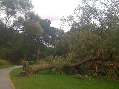
A tree knocked over in one of the recent thunderstorms, possibly the one that spawned all the tornadoes across southwestern Ontario.


5:49 PM Aug 30th: One tree knocked down the next:

One Tree Knocked Down The Next


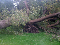
On closer inspection, I realized that the tree in the previous photo was actually two trees: the one had fallen on the other.


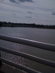
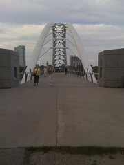
6:08 PM Aug 30th: The home stretch! Hope I don't run into Caribana this time...

The Home Stretch


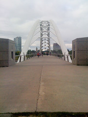
I return to the Humber River Bridge -- from here on home, I'm practically coasting.


6:56 PM Aug 30th: All done! ~95 km, not a bad ride.


And here's the whole thing. I'm trying out an online service called "MapMyRide" for sharing my rides. It's pretty good, but ad-heavy unless you spring for the paid membership. We'll see how it works out:


This map gives the length as 86.91km instead of 95km because I trimmed off the ends (so as not to give directions right to my house) and cut out a few wrong turns and dead ends. The "Dirt" markers are the two places where I ran into unpaved trails, and the red mountain marks the muddly climb out of Downsview Dells Park.
Read more!

Wednesday, August 19, 2009

Cycling: 650 Hours, 8100 km

A couple of weeks back, I posted the images I created from the GPS logs of my five years of recumbent cycling. I mentioned then that I was working on an animated version of those images, and I now have those up and working. I've split them up by year, with and without labels that track time, distance, date, and the bike & GPS models used.

I find these animations fun -- they bring back memories of the rides quite sharply. I don't expect others will have a similar reaction, but just in case you're interested, here they are.


YouTube has reduced the size of the videos from the original, so the text in the labelled versions isn't always that clear. I may re-upload these using videos created at YouTube's resolution at some point.

2004 - 69hrs, 850km

This was my first year with a recumbent, a Rans VRex. You can see my explorations of various trails that would be come regular rides: the Don Valley, Taylor Creek, the Waterfront, the Humber River, the Belt Line / Cedarvale Ravine loop, the Leslie Spit, the Islands, etc. The red path represents five minutes of cycling.


2005 - 76hrs, 823km

In my second summer of recumbent riding, I tended to stick to the same trails I'd explored in 2004. The two main exceptions are the Ride for Heart (I did the 50km route that year) and a trip out to Highland Creek in Scarborough, probably my longest single ride to date. We also took the bike up to Bruce County, where we vacationed for a week, and I did some nice loops up there.


2006 - 89hrs, 1113km

Early this year (May 6) was my first major failures. I was taking Lori's Catrike Speed out on a ride through High Park when I hit a rock or a log and bent the chain -- she had to come rescue me. Also, on May 28th, I tried to do a longer version of the the Highland Creek ride in reverse (parks first, then Kingston Road) and conked out around 70km, again needing rescue. Not all the big rides were failures, though. I was still doing the 50km route for the Ride for Heart, and on June 17th we took my Rans down to visit a friend in Mississauga so I could bike back on my first outside-Toronto recumbent ride. But the big ride was two month later, on August 16th, when I did my first (metric) century ride, up the Don Valley, across the top of North York, and down the Humber.


2007 - 145hrs, 1802km

In 2007, the VRex started showing signs of wear. I had to abandon two consecutive rides along the Belt Line loop because of mechanical problems, and we decided it was time to upgrade the bike. I moved up to a HP Velotechnik Streetmachine Gte, a recumbent with front and back suspension and under-seat steering. With the new bike, I decided to up the Ride for Heart to the 75km route, which worked great. I started expanding the Belt Line loop over to Prospect Cemetery for variety, and threw in a ride out to Port Credit, as well as some big loops through Scarborough and Etobicoke. In October we took a week's vacation in Haliburton, and I did some riding up there as well.


2008 - 144hrs, 1810km

Most of my riding in 2008 was pretty close to downtown -- I didn't get out to Scarborough or up to North York at all. But I made up for a lot of that on August 2nd, when I did my longest ride to date: almost 180km to Hamilton and back -- my first ride over 100 miles.


2009 (to August 17th) - 127hrs, 1676km

2009 isn't done yet, of course, but I have gotten some good rides in. Nothing out of town, but I pushed the boundaries of my Toronto riding to the limit -- literally, with an August 1st ride around the perimiter of the city. Other rides include a run up the Don Valley that was cut short at the north end by a massive thrundestorm that felled a tree right in front of me, and some nice rides east and west along the lakeshore. I've started replacing my Belt Line loop ride into work with one along the Waterfront Trail to High Park, then back along Dundas, which is nice and relaxing.


The Whole Thing

Finally, here's a single animation with all five years' of rides. Unfortunately, YouTube's compression really degrades the quality of this one, even more than the previous ones.


Read more!

Tuesday, August 18, 2009

Books: An Odd Litle Science Book

Way back in high school, I found a very odd book on relativity in the library. It was very thorough, getting right into the tensor math, but it was typeset almost like poetry -- one phrase per line, in a sans-serif font (though not Helvetica) -- and filled with surreal, Rudy Rucker-esque illustrations. I worked through all the math I could handle, but I didn't have enough tensor calculus to get through the whole thing.


A few months back, a science mailing list I'm on was in the middle of a big flame-war about relativity -- the usual "Einstein makes me uncomfortable, so he can't be right" sort of thing -- and I kept wishing I had a copy of the book around, as it was both the most thorough and easiest to follow non-textbook on the subject I'd ever run into. (Larry Gonick's chapter(s) on relativity in The Cartoon Guide to Physics were pretty good, but didn't get nearly as deep into the subject.)

Well, I was in Pages (a great independent bookstore in Toronto, which will unfortunately be closing its doors at the end of this month) looking for Neil deGrasse Tyson's new book, The Pluto Files (which I didn't find) and spotted a paperback that hadn't been there last time I was in: The Einstein Theory of Relativity: A Trip to the Fourth Dimension. I popped it open and immediately realized it was the book that I'd read way back then. I had forgotten the title and author's name, but there was no mistaking the format and illustrations.

It turns out it was written in 1945 by Lillian R. Lieber, with illustrations by Hugh Gray Lieber. It's definitely one of the oddest serious science books I've ever run into. In many ways, it feels like one of those books that tries to explain how quantum physics explains the author's favourite form of mysticism -- like the ones Fred Alan Wolf would put out -- with odd typography and illustrations (and USE of
CAPITALIZED WORDS), but it also completely ignores the old publisher's adage about "ever equation cuts your audience in half": by that rule, I must be the only person ever to have read it.

To give you a feel for the book, here is the conclusion, aka THE MORAL, typeset approximately as below:

Since man has been
so successful in science,
can we not learn from
THE SCIENTIFIC WAY OF THINGKING,
what the human mind is capable of,
and HOW it achieves SUCCESS:

I. There is NOTHING ABSOLUTE in science.
Absolute space and absolute time
have been shown to be myths.
We must replace these old ideas
by more human
OBSERVATIONAL concepts.

II. But what we observe is
profoundly influenced by
the state of the observer,
and therefore
various observers get
widely different results --
even in their measurements of
time and length!

III. However,
in spite of these differences
various observers may still
study the unvierse
WITH EQUAL RIGHT
AND EQUAL SUCCESS,
and CAN AGREE on
what are to be called
the LAWS of the universe

IV. To accomplish this we need
MORE MATHEMATICS
THAN EVER BEFORE,
MODERN, STREAMLINED, POWERFUL
MATHEMATICS.

V. Thus a combination of
PRACTICAL REALISM
(OBSERVATIONALISM)
and
IDEALISM (MATHEMATICS)
TOGETHER
have achieved SUCCESS.

VI. And,
knowing that the laws are
MAN-MADE,
we know that
they are subject to change
and we are thus
PREPARED FOR CHANGE.
But these changes in science
are NOT made WANTONLY,
BUT CAREFULLY AND CAUTIOUSLY
by the
BEST MINDS and HONEST HEARTS,
and not by any casual child who
thinks that
the world may be changed as easily
as rolling off a log.

Has anyone else ever seen this book?
Read more!

Wednesday, August 05, 2009

Five Years, More or Less

So what do you suppose this is?


It looks sort of like a doodle someone might make during a boring meeting at work, kind of a make-some-random-dots-and-sketch-in-lines thing.

How about this one?


A litle more relaxed and curvy -- maybe the meeting was less stressful, so the lines are more relaxed and fluid.

Actually, they're both part of the same thing. Let's pull back a bit:


Recognize it? Maybe if we pull back some more:


Torontonians may have figured things out at this point: it's a sketchy map of Toronto. I drew it myself -- but not by hand. Over the past five years, I've drawn this map with my bike.

A few years ago I pulled a muscle in my back, and ever since, riding a regular bike for more than half-an-hour has been painful. Then, in 2004, I got a Rans V-Rex recumbent, which not only made long rides possible, but revived an old fondness for cycling that had faded for a while in Toronto, even before my injury. I lateer upgraded to an HP Velotechnik Streetmachine Gte.

Except for my first ride on the V-Rex, a tour of Sunnybrook Park, I've had a GPS on all my rides, long and short. On that first ride, I realized how fun it was to get out on a bike again, and I wanted to keep track of everywhere I rode, and how much riding I did. I wrote some software to go through the GPS logs and work out some stats on how much riding I'd done, and started playing with importing the maps into Google Earth.

While experimenting with Google Earth, I noticed that, if I made the tracks as thin as possible (instead of the several pixels thick that's the default), I got this sketchy effect. And if I blanked out the map, it took on an odd feeling, kind of like a medial image -- especially if rendered as white on black. This shot of downtown, around where I work, gives a good example:


Downtown Core


By the way, all of the white-on-black images in this post link to larger versions, and if you mouse over them, you'll get labels of some key features. If you aren't getting the labels, wait a few moments and try again -- it might not have downloaded the alternate images completely.

This image shows off the medical feel pretty well, I think. You can see that I do most of my east-west riding on Gerrard, Dundas, Queen, and Richmond. Most of the north-south is on Spadina, Beverly, and University. In the upper left is the university -- King's College Circle is quite clear, as is half of Spadina Circle. In the lower right, the streets are fuzzier and sketchier -- as is the stretch of College where it crosses Yonge. Why would that be?

GPS receivers work by catching signals from orbiting GPS satellites. Each signal has a time stamp that lets the GPS know how long it took the signal to get from the satellite to the GPS unit -- and it knows the exact position of each satellite as it orbits. Knowing the distance to three satellites lets the GPS triangulate and figure out its location -- within a margin of error. The more satellites the GPS can lock onto, the more accurate the position information.

Unfortunately, the GPS satellite signals tend to bounce off of buildings. If the buildings around you are short, or spaced far apart, this isn't a big deal -- but in the canyons of a downtown core, it can bit a big pain. I've had the GPS tell me I was in Nathan Phillips Square when I was actually 500m away. So, in addition to giving a history of my rides, this gives you a sort of GPS accuracy map.

Here's more of downtown:


Downtown


This map shows off what I call "the Long Way Home" -- A 20+ km loop that runs up through the University to Cedarvale Ravine, up to the south end of the Allen Expressway, then down the Belt Line trail to Mt. Pleasant Cemetery, and finally south through Rosedale to home. There are a few variations -- you can see a fainter line that runs from Mt. Pleasant in a curve around Rosedale: that's the Moore Park Ravine trail, which runs past the Brickworks, which I take when I want a slightly longer ride.

I haven't used that route much this year, as I've been experimenting with other long rides, but I've done it enough that it's one of the most prominent features of my bike's-eye view of Toronto.

Here's another favourite ride, which I call the "Taylor Creek Loop":


Taylor Creek Loop


Of course, there's much more here than just that one loop: every time I've crossed east Toronto is in here. The Taylor Creek Loop runs along the Waterfront Trail to the east end of the Beaches, then up Victoria Park to Taylor Creek. From there, I go west along the creek and south along the Lower Don trail, back to where I started. It's around 35km, a nice couple of hours. The only downside is climbing the hill from the beach to Kingston Road.

One of the fun things about this map is that there are little details all over it that call up memories. This is an obvious one: my first ride on my first recumbent. I said above that I didn't have a GPS for that ride, so I've faked it -- I went back later with a GPS and re-rode the route, then re-labelled the track with the time of the original ride (more or less):


Sunnybrook Park


The map here shows the West Don trail coming up the Don Valley from the south. It branches into the Wilkit Creek Trail going north (the route you take if you want to head to North York) and the Sunnybrook Park road going west. The first ride started from the parking lot that's just south of that fork -- the little squiggle below the line -- and ran up around the sports fields. Not a long ride, but I was a little unsteady on the bike at that point.

You can also see three tracks heading west. The north shows the one time I biked along the dirt trail that continues along the Don. A little rough for a recumbent. The south one was from a geocaching trip with L -- we biked up the hill, then walked to the cache (the walking part is in paler grey). The middle track is how I get into the Don Valley when I'm coming from the west -- through Sunnybrook Hospital grounds and down the hill. I've done that ride several times.

Another memory triggered by the map:


Mount Pleasant Cemetery


This shows the area around Mt. Pleasant Cemetery. You can see the bright line that's part of the "Long Way Home" route, which cuts through Mt. Pleasant, but you can also see the roads of the cemetery themselves. Those mostly arise from two trips.

The first was another geocaching run. There's a puzzle cache set in Mt. Pleasant that involves looking up dates & figures on tombstones & mausoleums, then plugging those into a formula to get the location of the final cache. Most of the roads you see on the east side are from that trip, though some on the west are as well. The final cache itself was about halfway down Moore Park Ravine.

The second trip accounts for most of what you see in the western half of the cemetery. The oral surgeon who did my molar implant is just north of Mt. Pleasant - you can see some trails that go up to his office in this image. I always biked up, but one day I misread the time and arrived and hour early. To pass the time, I tried to bike all the roads in the west half of the cemetery -- and I got most of them. It was a fun morning.

By the way, you can see the Brickworks trails in the lower right of the image as well.

Here are a few other maps that I thought were kind of fun:


Don Valley


This shows the junction between the Lower & West Don trails and Taylor Creek. Up through the middle is a very smooth set of tracks -- that's the Don Valley Parkway, from the Ride for Heart, which I've done every year since 2005 (I couldn't in 2004, as I didn't get my bike until the end of June).


Highland Creek


I haven't biked Highland Creek all that often -- I've brightened it here, as on the full map it comes out quite faint -- but it's a really nice ride. The only problem is that it takes a couple of hours just to get there.

On the left, you can see a long, thin rectangle. This is the Lawrence St bridge over Highland Creek. I either come from the west and go along the south side of this rectangle to the traffic lights, where I cross, then backtrack to the trail; or come down the trail and go along the north side to the other traffic lights, where I cross and backtrack to the south road. It makes for an odd feature on the map.

The diagonal that comes down from the top of the curve of the creek is Kingston Road. It only actually connects with the creek trail because a storm washed out part of the bike path earlier this year, forcing me out of the valley.

Last year they opened a bridge over Highland Creek, which means I can now bike further east -- that's the line heading off the right edge of the image.


High Park


High Park is fun to explore by bike. In this image, you can see the curve of the Waterfront Trail as it goes around Humber Bay. Just north of that is the DVP from the Rides for Heart, then High Park itself. I'm currently using the south-east corner of the park as part of my most recent "Long Ride To Work", along the waterfront, up through the park, and back towards downtown along High Park Boulevard.


Ride for Heart Turnaround


I wanted to put up an image showing the full Ride for Heart track, but it spans so much of the city that it tends to get lost among everything else. This is just the north end, where the route turns around at York Mills. It reminds me of a long-stemmed flower of some sort. The faint track cutting across is from a ride loop I did out into Scarborough.


Toronto Island


I haven't been riding on the Islands since we got Cobalt, but they are fun to bike on (if not particularly challenging). They have a nice, pleasing shape to them, too.

So, here's the full map. Last Saturday's 140km ride was the first ride I've done specifically to put something in this image -- namely, the border of Toronto (more or less). Before that, I had some of Steeles and some of Etobicoke Creek, but that was about it.


Toronto


As for those stats I mentioned... As of August 5, 2009, I've done about 560 hours of riding totalling 8240km. 2920km on the V-Rex, 5180km on the Streetmachine, and the rest on L's trikes. Not all of that total is represented on this map: this doesn't show the rides in Grey County, Haliburton, or down towards Hamilton. But this map should account for very nearly 8000km of cycling, which isn't bad when you consider that Toronto is only about 20km x 40km.

I'm also working on an animated version of this -- that'll come later.
Read more!

Sunday, August 02, 2009

Cycling: Around the World (Well, Toronto)

Almost a year now since the last post. That's a little longer than I meant to leave things idle.

I've actually been working on something I intend to post, but it's not quite ready yet. One of the things I wanted for it was a GPS track of the (approximate) boundaries of Toronto -- so, yesterday, I biked the border, as best I could.

You can't actually bike the exact border. Sure, the north edge is easy -- 40km straight of Steeles -- but you can't ride through the Rouge River valley, and taking the paths along Etobicoke Creek is hindered by a couple of missing bridges. But I did the best approximation I could.

For extra fun, I decided to try live-tweeting the ride, and I've collected the tweets below, with some extra comments.


The photos are all taken using my iPhone, which presented a few problems: the iPhone camera has a fixed, wide-angle lens, so there isn't a lot of flexibility in composition; and the Sun was bright enough that, most of the time, the only things I could make out on the screen were silhouettes.

Note that some tweets didn't send properly at the time I composed them, and I ended up re-submitting them when I went to write the next tweet -- so the time stamps can't always be trusted!


7:47 AM : Trying an experiment today: gonna tweet my bike ride. But first: silly cat photo!


But first: silly cat photo!


I needed to try the TwitterFon app to see how you posted photos with it, and Mouse provided a perfect subject.


8:10 AM: Ok, ready to go. First stop: Cherry Beach!

Ok, ready to go


The Streetmachine Gte, sporting a new chain & cassette thanks to the wear and tear of 5000km of riding having worn the teeth of the old one.


8:26 AM: At Cherry Beach. Now for an hour of running with the pups.

At Cherry Beach


Often when doing long rides on weekends, I bike down to Cherry Beach and meet L there with the dogs. We do our usual morning dog-walk, then she takes the dogs home and I continue on my way.

As I was leaving Cherry Beach, I started getting "network failure" messages, and my tweets didn't get through. The problem continued for a while.


10:44 AM: Twitter problems... Testing...
10:46 AM: Ok, seems to be working. Getting food at Kingston & Eglinton. Here's the new Unwin bridge:

Here's the new Unwin bridge


Finally, after a couple of hours, things were working again. I had taken a photo of the new Unwin bridge, which had only recently re-opened, so I forwarded it once I had the network back.


11:17 AM: Looking out at Darlington as I approach Highland Creek. 1/3 done

Looking out at Darlington


There's not that much to see between the Beaches and Highland Creek, but once you're approaching the creek, you get a good view of the Darlington power plant. Unfortunately, the wide-angle lens on the iPhone reduces tht part of the view to a tiny fraction in the middle.


11:20 AM: This bridge over Highland Creek is fairly new. Before, I'd have to turn north here.

This bridge over Highland Creek is fairly new


My usual Scarborough path is out to Highland Creek, then up along the creek in a big semi-circle that curves back through Colonel Danforth Park towards the Scarboro Golf & Country Club. This bridge went in fairly recently -- last summer, I think -- and this is only the second time I've ridden across it


11:33 AM: The Rouge River pedestrian bridge.

The Route River pedestrian bridge


Not far past the Highland Creek bridge is this bridge over the Rouge River. The city's building a bike trail all the way here, but for now you have to cross the GO tracks at Rouge Hill (there's a level crossing) and take Lawrence Ave E to get here.


11:43 AM: I've never biked in Durham before...

I've never ridden in Durham before


I'd only ever gone as far east as the Rouge Hill GO station before. Next time I'm out this way, I'll continue along the Waterfront Trail to Darlington. I'm going up through Pickering because you can't bike through the Rouge River park (so far as I know).


12:24 AM: Petticoat Creek:

Petticoat Creek


Around here, the hills started getting annoying. Not that you can tell in this wide angle shot.


12:31 AM: Hard to climb on a recumbent:

Hard to climb on a recumbent


This doesn't really show the steepnes of the climb very well. Recumbents are great for long rides, but for climbing hills you have to rely entirely on your gearing -- you can't stand on the pedals to use your weight.


12:37 AM: Finally! Steeles. 40km to the next turn.

Finally! Steeles. 40km to the next turn


I'd never been out this far on Steeles. It was more rural than I'd anticipated -- though I have no idea why I should have expected anything else.


12:44 AM: A reminder of how far east I am:

A reminder of how far east I am


This sign is pointing south to the Zoo. I don't think I've ever been inside Toronto north of the Zoo before.


12:49 AM: Moo.

Moo


Wildlife! Sorta.


1:01 PM: 52km - Time for a breather and a drink.

I spotted a pharmacy and grabbed some water.


1:32 PM: Pacific Mall - the heart of Little Hong Kong.

Pacific Mall - the heart of Little Hong Kong


Good green tea ice cream there.


1:49 PM: Almost half way. Lunch break!

Traditionally, when on long rides, I do a McDonald's breakfast and a Wendy's lunch. Not sure why.


2:28 PM: Gah! Nettles!

Gah! Nettles!


I zipped through these plants, and it was only as I hit them that I realized they were stinging nettles.


2:38 PM: Long climb ahead:

Long climb ahead


Again, the wide-angle really downplays the climb.


2:51 PM: Yonge St - Halfway done Steeles:

Yonge St - Halfway done Steeles


The city boundary along Steeles runs 40km in a straight line. I think that's the longest I've ever actually ridden in a straight line...


3:11 PM: I'll have to check this place out some other time:

I'll have to check this place out some other time


This connects in to G Ross Lord Park, which I've ridden in before.


3:21 PM: York University:

York University


It's in behind the trees somewhere. I've been here a few times on my bike, usually when riding Black Creek's paths.

Around this time, I was starting to worry that there might be a storm coming. Wouldn't be the first time I'd've been caught in a downpour on Steeles.


3:36 PM: Across from Radioworld, my fav GPS store. Time for a drink.

Across from Radioworld


Radioworld is a great GPS store, though my current Garmin Oregon 300 comes from Mountain Equipment Co-op.


4:22 PM: Here we are - The west end of Steeles. It's downhill from here!

Here we are - The west end of Steeles


Looking back the way I came. Not quite as rural as the other end.


4:30 PM: Abandoned road & Hindu temple:

Abandoned road & Hindu temple


Indian Line Road is falling into disrepair. No cars are allowed at this point. It provides a back way into Indian Line Campground on Claireville Lake, next to Wild Water Kingdom. The somewhat incongruous temple in the distance is the new BAPS Shri Swaminarayan Mandir, which opened in 2007.


4:33 PM: On the Claireville Dam:

On the Claireville Dam


A quiet view of Claireville Lake, with the campground off to the left. I exited the park through the campground, with lots of kids yelling "Cool bike!" as I rode past.


4:45 PM: Hmm... I didn't know about this:

Hmm... I didn't know about this


Another set of trails to explore!


5:15 PM: YYZ:

YYZ


Not just an instrumental by Rush, it's also an airport!

Not that you can see much of anything in the photo -- I just figured that, since this is the closest I've ever biked to the airport, I should get a shot.


5:24 PM: 100km - Yay! 30km left - 1.5-2 hours.

At this point, I've exceeded my original time estimates for the ride. These estimates also will not hold, for a few reasons.


6:19 PM: Hmm... Can't get down Etobicoke Creek yet...

Hmm... Can't get down Etobicoke Creek yet...


The city border runs down Carlingview, past the airport to Eglinton. It then follows Eglinton to Etobicoke Creek, and runs down the creek to the lakeshore. I thought I might be able to head down this street, Rakely Court, and find a trail along the creek, but no luck.

The image is oddly skewed because the iPhone's camera uses a scaning method for pulling the image off the sensor chip, and I moved the camera while it was doign this. It's an interesting effect, but not at all what I was after.

It turns out, after later investigation with Google Maps, that there is a path at the creek, but I missed it this time around. I may do the Humber-Eglinton-Etobicoke Creek loop to fill that in later. The big problem is that, as near as I can tell from Google Maps, the bridges are out on that path:


6:20 PM: Hey, I'm not the only one!

Hey, I'm not the only one!


Usually, when I do the Etobicoke Creek-to-lakeshore path, I join the creek at the south end of Centennial Park and follow that to Dundas. At that point the path stops, and I take The West Mall down to this Tim Hortons, grab a drink, and rejoin the creek with the new path. This is the first time I've stopped anywhere (except the Urbane Cyclist) and seen another recumbent parked outside!


6:33 PM: Nice talk with the owner of the Bacchetta.

We chatted about over-seat stearing vs. under-seat, long-wheel-base vs. short-wheel-base, and sundry other recumbent topics. The rider's husband joked that, whenever he rides his plain green bike along behind his wife's Bacchetta, he might as well be invisible.


6:52 PM: Finally! Back at the lake. Revised time estimate: 45-60 mins

Finally! Back at the lake.


The talk with the other recumbent owner delayed me an extra 15 mins, but this is the home stretch now!


7:26 PM: First sight of downtown on the home stretch:

First sight of downtown on the home stretch


This is somewhere around 5th Street in Etobicoke. Once again, the wide angle on the camera kinda minimizes the effect.


7:27 PM: Humber bridge:

Humber bridge


It was shortly after this that I started realizing that I'd mis-remembered when Caribana was...


7:34 PM: Busy down here:

Busy down here


Sure, it started a couple of weeks ago...


7:37 PM: Very busy:

Very busy


But the parade was today!


8:16 PM: Almost there...

I backtracked to Parkside and worked my way back north to Dundas, then College. This was tweeted from College & Bay.


8:24 PM: There... All done!

There... All done!


And home.


Final tally: 141km, 12h30 including dog park, two meals, and other stops. And I really should have remembered that it was Carribana...


Here is the overall route:


Read more!