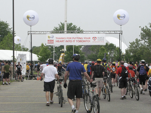
Sunday was the 2007 Toronto Ride for Heart, during which the city closes the Gardiner Expressway and the Don Valley Parkway (DVP), the two downtown freeways, to car traffic and opens them up for cyclists and roller-bladers, who raise money for heart disease research. This year was my third time doing the ride.
Cyclists have a choice of 25k, 50k, or 75k routes, and roller-bladers can do 5k or 10k. All routes start at the west end of the Canadian National Exhibition (CNE) grounds. The 25k and 50k routes head east along the Gardiner, then down onto the northbound DVP. The 25k turns around at the Bayview-Bloor exit, while the 50k continues north to York Mills, then turns and comes all the way back.
The 75k is a little more complicated: it goes
west along the Gardiner to the Kingsway exit,
then turns east and joins the 25k and 50k routes. After turning around at York Mills, it goes south to the Bayview-Bloor exit, then turns north
back to York Mills, then heads south and back to the CNE.
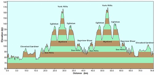
There are some serious climbs on the route. On the 50k and 75k routes, the overall climb is about 90m from the lowest point to the highest, but thanks to the ups and downs of the overall route, there's about 600 vertical meters' worth of climbing over the 75k route (in part because it does the bulk of the climbing twice!).
The first two times I did the ride, I did the 50k route. I'm not a particularly ambitious cyclist -- especially compared to some of the other people on this ride! -- but I had set myself a goal of maintaining a moving average of at least 20 km/h over the ride. I was rather pleased that I not only managed that, but I kept my
overall average speed -- including rest stops -- over 20 km/h also. This year I decided to try the 75k route, with the same 20 km/h goal.
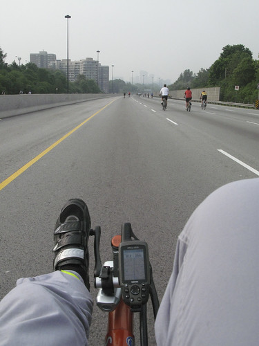
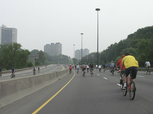
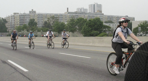
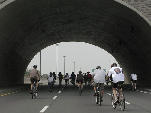
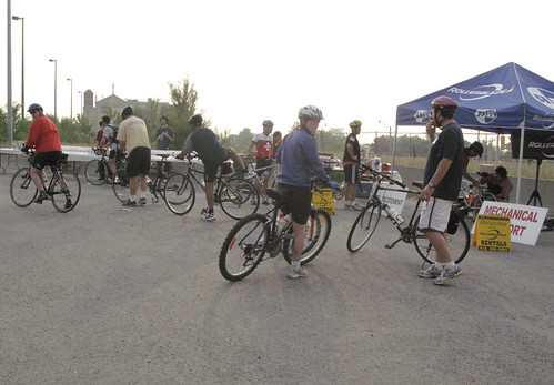
The trouble with the 75k route is that you have to show up for 6:45 to get in on it. Actually, only a select few cyclists actually start at 6:45: hard-core racers can arrange to be at the front of the line so they have the entire freeway to themselves as they do the route (at least until they've turned around at Bayview-Bloor to head north again -- more on that later). Still, the rest of us are all underway by 7:10.
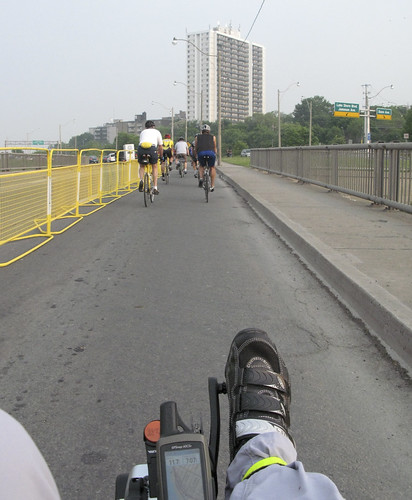
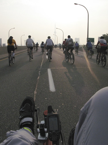
The first leg is along Lakeshore Road going west to the Gardiner westbound on-ramp. This was new to me -- the 50k route takes the eastbound on-ramp that's right by the CNE exit.
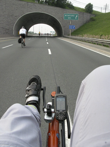
 225 m into the ride
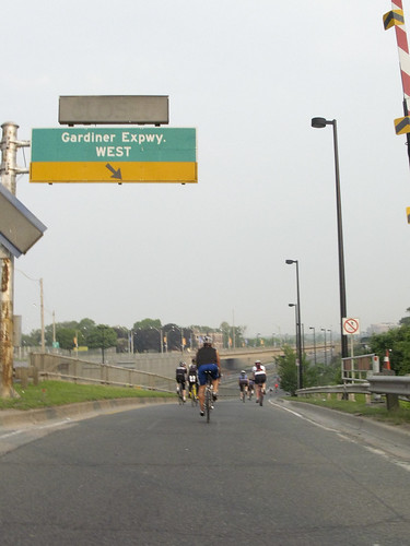 580 m into the ride
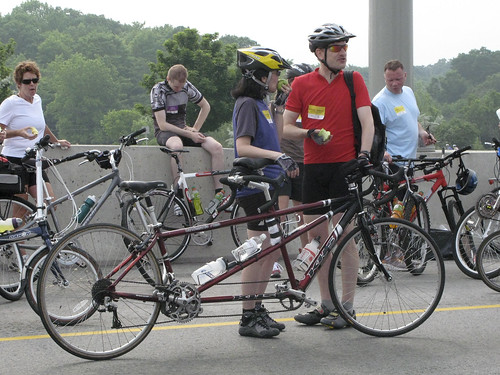
There are rest stops all along the route. This was the first, just after the Kingsway turnaround. They have lots of water, as well as apples, oranges, and bananas, and mechanical service stations.
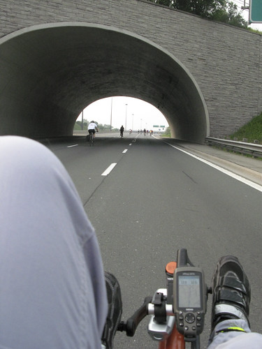
 4.2 km into the ride
The day was rather overcast and threatening rain (in fact, it did rain a little towards the end of my run), which is actually perfect weather for this -- no hot sun to burn your skin and bake the fluids from your body. Still, once we turned around at Kingsway, we were riding into the sun for a while, which was pretty bright in spite of the clouds.
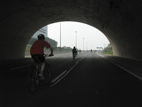
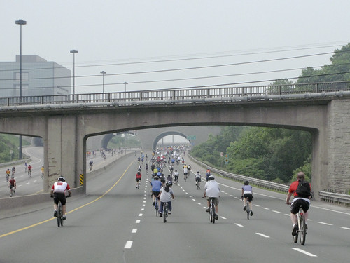
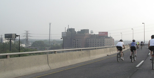
This shot is from the first major climb: from the Gardiner at ground-level to the elevated Gardiner, a climb of about 20 m over 2.3 km, followed by a nice relaxing downhill run that drops 11m over 1.4 km.
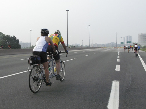
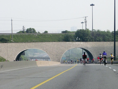
 8.4 km into the ride
Taking photos from a moving bike is tricky, especially when you're doing 30 km/h, so I didn't quite get the angle I wanted for this one. If you look closely behind the railing, you can see the ramp down from the Gardiner to the northbound DVP, a drop of 18m over about 515m -- you get going pretty fast down here! Naturally, I don't have any photos from when I was actually going
down that, as I topped 40 km/h for the first time in the ride on that one.
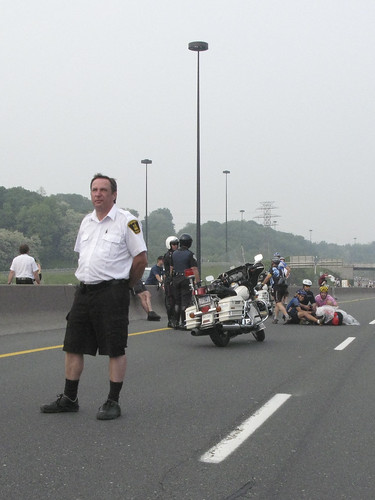
The first time I did the ride, I didn't know that the left-hand lane has a manhole at the bottom of the hill that isn't quite flush with the road, and hit that at about 45 km/h. Fortunately, I made it over, but someone else wasn't as lucky: on my way back, there was an ambulance at that spot.
 14.6 km into the ride
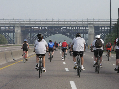
The Bloor Viaduct is a major landmark on the ride. It marks the end of the first climb after getting off the Gardiner (20 m in 2 km), and tells the 25 km riders that they're getting close to their turn-around.
This year as I was approaching the bridge, a TTC maintenance train was heading from Castle Frank station to Danforth -- you can just barely make it out among the girders under the roadway. It honked its horn at the cyclists, and a maintenance worker on the front waved to us as we went by (he's hard to spot, but if you click the image it'll take you to the Flickr page, where he's highlighted).
 17.4 km into the ride
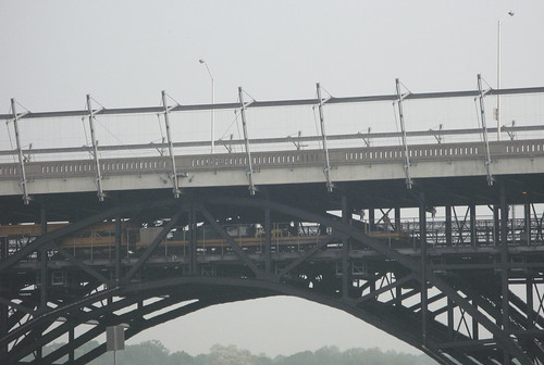 17.5 km into the ride
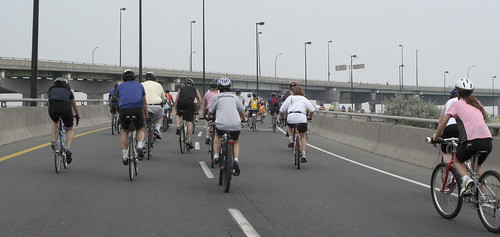
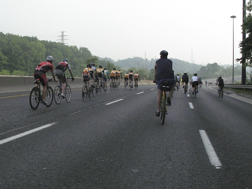
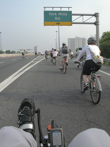
Just after I passed the Bayview-Bloor exit -- the point where 75k riders coming south turn around to go north again -- a car came up behind me. I had plenty of warning, though, as it was driving slowly with a megaphone going "The leaders of the 75k are coming up behind you! Please move to the right lane!" over and over. These are the hard-core cyclists who start right at 6:45 and ride the whole route like a race. At this point, I was 50 minutes into the ride, and had covered about 19 km, but they'd covered almost 43 km. They had a
bit of a head start, as they started about 20 minutes ahead of me, but even so... My average speed (including stops) at this point was about 23 km/h. Theirs was over 37! And I hadn't even done the big hills yet!
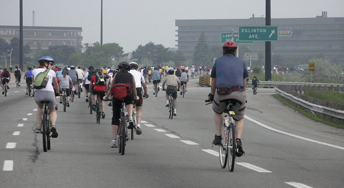
 19.2 km into the ride
The first really big climb is the run up from Don Mills Road to Eglinton. The Parkway actually leaves the valley here, climbing to above grade in East York for a while before diving back down. Overall, the climb is 45 m (half the total vertical climb from the bottom of the DVP to York Mills!) in 3.2 km.
The first time up this year, I was struck by how much easier it was with the new bike. This climb was always daunting -- it's not the steepest on the ride, but it is the longest without a break -- but it went really smoothly with the new StreetMachine, and I managed to take the climb at an average of 20 km/h.
The second time up, I was a little less enthusiastic, though I did keep my speed on the climb at 19 km/h.
 21.4 km into the ride
After the longest hill comes the steepest. The DVP heads back into the valley in a drop from Eglinton to Lawrence of 26 m over 1.2 km. It's great fun -- though a little daunting! -- one the way
north... On the way south, it's the nastiest climb of the route, and one of the main reasons why I did 50k instead of 75 last year.
 25.5 km into the ride -- 1/3 done!
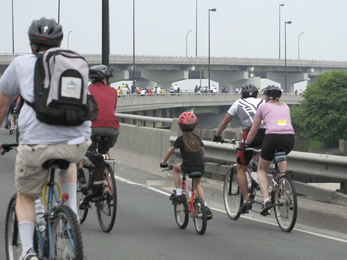
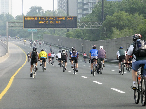
The last climb (going north) is from Lawrence to the turnaround at York Mills, 52 m over 2.5 km. It's higher and shorter (horizontally) than the Eglinton climb, but it's not as bad overall because there's a level section about halfway up that lets you catch your breath. The city chose this place to put a pixel board that provides helpful advice that was rather wasted on us cyclists.
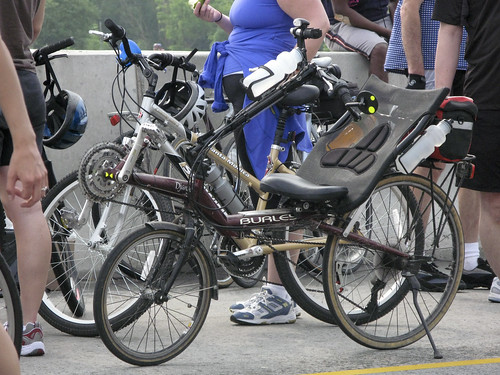
 27.6 km into the ride
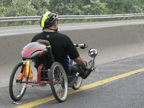
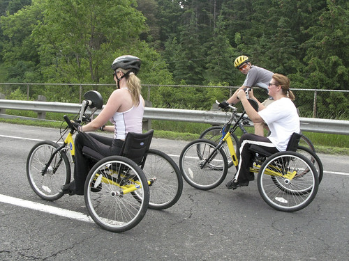
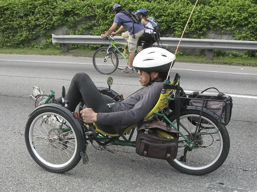
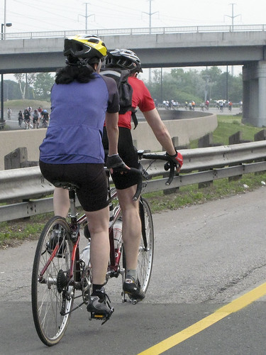
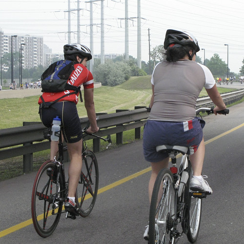
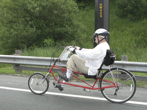
I wasn't the only one out on a non-standard bike. Here's a recumbent style known as a "long wheel-base" or LWB -- It puts the front wheel in front of the pedals, instead of behind like on my SWB (short wheel-base). They're easier to get used to, since the position is more natural, but they're hard to fit into cars!
 28.3 km into the ride
Finally, the top of the last climb! The route leaves the DVP at the York Mills exit, then heads around to the other side of the cloverleaf to get back on going south. There, there's another rest stop (my third of the ride) and the start of the longest descent on the route (slightly longer than the climb, since the rest stop is a little higher than the York Mills off-ramp was).
 28.5 km into the ride
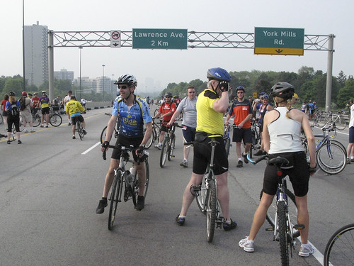 29.3 km into the ride
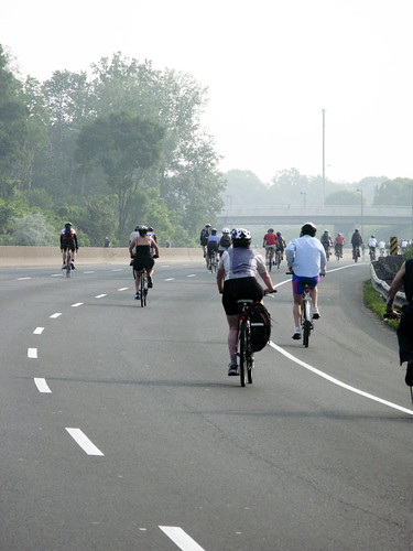
The last two times, this was the halfway point -- this time, it's not quite 40%! Time to take a break.
Update: Corrected some of the distances and fleshed out the bit about the 75k leaders. Added links to other parts.
Read more!